
 Planning
South Tenerife Without a Car: Buses, Walks & Easy Day Plans
Choose a practical southern base, reach it from Tenerife South Airport and plan beach days using walking routes and official TITSA links.
Read guide
A practical guide to driving in Tenerife — rental cars, road rules, TF-1 and TF-5, mountain roads, parking, emergencies and scenic-route planning.
For many visitors, yes. A car makes it much easier to combine the coast with Teide, Anaga, Teno, traditional towns and viewpoints on your own timetable. You do not need a car for every Tenerife holiday, though: if you are staying around the main southern resorts and plan mostly beaches, organised excursions and local buses, renting only for selected days can make more sense.
The important part is not the island's size but its terrain. Tenerife rises quickly from sea level into mountain country. A route that looks short on a map can include steep climbs, hairpins, fog, cyclists and limited parking. Build extra time into mountain days and avoid planning them like motorway transfers.
Prefer a holiday without a rental car? See our South Tenerife Without a Car guide.
Traffic side
Drive on the right.
Motorways
TF-1 serves much of the south and east; TF-5 is the main northern motorway. Follow posted signs and live traffic information.
Generic car speed limits
120 km/h on motorways/autovías; 90 km/h on conventional roads; urban defaults are generally 20/30/50 km/h depending on street layout. Posted lower limits always take priority.
Emergency number
112 for emergencies in the Canary Islands, 24/7.
Mountain roads
Allow more time than the distance suggests. Expect bends, elevation changes, cyclists and rapidly changing visibility.
Before a mountain day
Check weather, road incidents/closures, fuel level and your return route before leaving the coast.
A valid EU or EEA driving licence is valid for driving in Spain while it remains in force. For visitors using licences issued outside the EU/EEA, the requirements depend on the licence and country; Spain's DGT advises travellers to check validity before the trip and, where required, carry an International Driving Permit together with the original licence and passport.
For a rental car, confirm exactly what the company requires at collection: original driving licence, passport or ID, payment card, minimum driver age and any additional-driver conditions. Rental-company rules can be stricter than the legal minimum.
Official DGT guidance for foreign drivers and required documents.
For ordinary cars, Spain's generic maximum is 120 km/h on autopistas and autovías and 90 km/h on conventional roads. In towns and cities the general limits are 20 km/h on shared-level streets, 30 km/h on roads with one lane in each direction and 50 km/h on roads with two or more lanes in each direction. Signs can impose lower limits, and mountain conditions often require speeds well below the legal maximum.
Seat belts are compulsory. Holding a mobile phone while driving is an offence, and there is no extra 20 km/h allowance for overtaking on conventional roads. Do not drink and drive; alcohol and drug enforcement is active throughout Spain.
Children 135 cm tall or shorter must use an appropriate approved child-restraint system. If you are renting, reserve the correct child seat in advance rather than assuming one will be available at the desk.
The main motorway network is straightforward compared with Tenerife's mountain roads. TF-1 links the southern resorts with the airport and continues around much of the east and south-west. TF-5 is the key motorway through the north. These roads make longer transfers fast, but congestion can change journey times dramatically around commuter periods and major works.
Do not build an airport run around the best-case navigation time. Add a buffer for traffic, refuelling and the rental-car return process. For live incidents and closures, the Cabildo de Tenerife road-information map is more useful than relying only on a static route estimate.
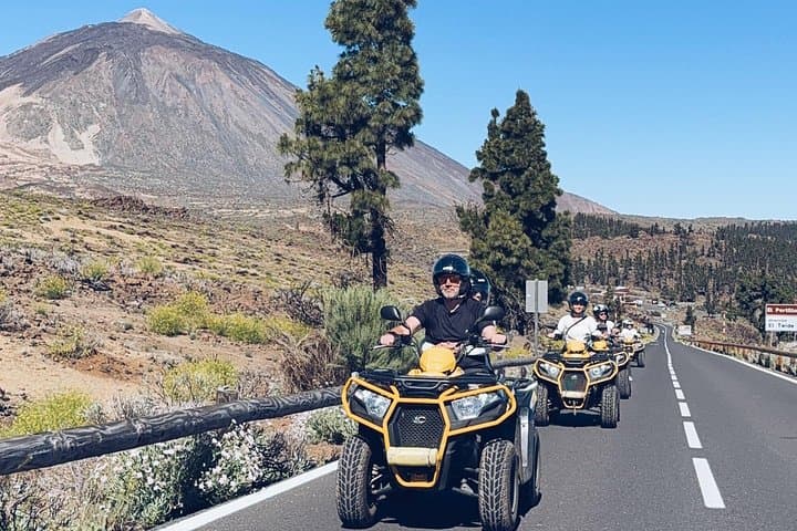
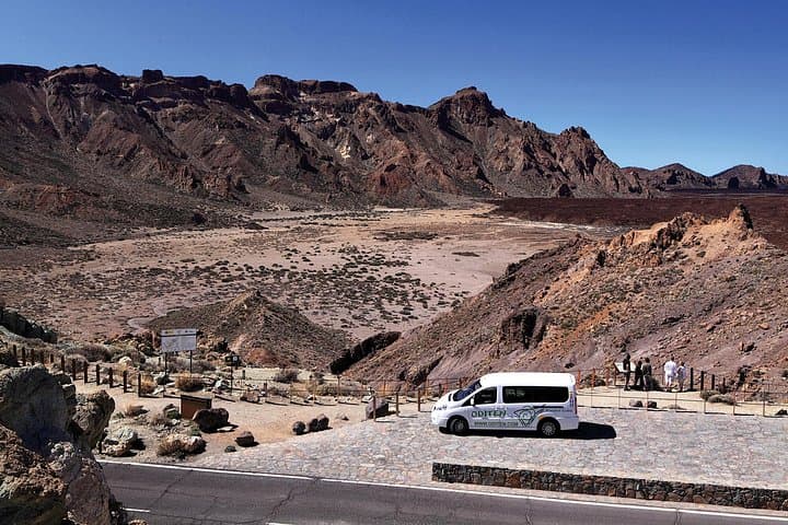
Driving into Teide National Park is one of Tenerife's great road trips. The climb changes quickly from populated coast or northern greenery to pine forest and then open volcanic highlands. The road is generally paved and well defined, but altitude, strong sun, cloud, wind and occasional winter conditions can make the experience very different from the coast.
Start with enough fuel, water and warm layers. Do not assume that a warm beach forecast describes conditions above 2,000 metres. Use designated parking and viewpoints rather than stopping on a bend or road shoulder for a photograph.
From €85
View →via Viator

From €886
View →via Viator
From €160
View →via Viator

Non-refundable
From €178
View →via Tiqets
Booking and payment take place securely with our partner. GoToTene may earn a commission at no extra cost to you.
Anaga feels much tighter than the motorway map suggests. Roads climb through laurel forest, cross ridges and descend towards small settlements and the Atlantic. Visibility can change quickly when cloud moves across the mountains, and some sections feel narrow to drivers used to wide northern-European roads.
Drive defensively, expect cyclists, use legal parking areas and let faster local traffic pass only where it is safe. If weather or visibility is poor, shorten the plan instead of forcing a full scenic loop.
The mountain roads around Teno and Masca are among the drives most likely to surprise first-time visitors. Expect sustained bends, steep drops, tight sections and traffic moving in both directions. The scenery is spectacular, but this is not the place to rush or follow a navigation app blindly into a stressful schedule.
If someone in your group dislikes exposed mountain roads, consider an organised excursion or choose an easier road trip instead. When you do drive, use proper parking, avoid stopping in the carriageway and give yourself time to enjoy the viewpoints without creating a queue behind you.
Parking is easiest when you treat it as part of the itinerary. In busy resorts, La Laguna, Puerto de la Cruz and popular mountain stops, the closest space is not always the best choice. Use signed public parking or marked spaces and walk the final section when practical.
Never assume an empty roadside space is legal. Check signs, road markings, temporary restrictions and access rules before leaving the car. At natural sites and mountain viewpoints, do not create an informal parking place on a bend or narrow shoulder.
A compact rental car is often easier than a large SUV for town parking and narrow mountain sections unless your group genuinely needs the extra space.
From 1 January 2026, Spanish-registered cars must carry a connected V-16 emergency beacon for signalling a vehicle immobilised on the road; it replaced the traditional warning triangles as the legal signalling device for these vehicles. A rental car in Spain should therefore have the required equipment, but it is worth locating it before you need it.
If there is an emergency in the Canary Islands, call 112. For a breakdown without immediate danger, follow the rental company's roadside-assistance instructions and avoid standing in a live traffic lane.
 Volcanoes & TeideTickets
Spain's highest peak (3,715 m) and a UNESCO World Heritage volcanic landscape at the heart of Tenerife.
ViewpointsAn ancient laurel-forest massif of knife-edge ridges and remote hamlets in Tenerife's north-east, a UNESCO Biosphere Reserve.
 Viewpoints
A remote mountain village set among the dramatic ridges and gorges of the Teno massif in north-west Tenerife.
 Museums & Culture
A beautifully preserved former Atlantic trading port reshaped by the 1706 volcanic eruption, with historic streets, old harbour remains and lava-formed sea pools.
Teide Scenic Drive — the classic climb into the volcanic highlands.
Anaga Scenic Drive — forest ridges, viewpoints and the island's wild north-east.
Teno & Masca Route — dramatic ravines and mountain scenery in the west.
North Tenerife Scenic Loop — traditional towns and the greener north.
South Tenerife Coastal Route — an easier road day linking beaches and southern towns.
This guide uses current official Spanish and Tenerife road information, then turns it into practical trip-planning advice. Rules and temporary road restrictions can change, so check the linked official services before driving.
DGT — information for foreign drivers and required documents.
DGT — current traffic recommendations and generic speed limits.
Cabildo de Tenerife — roads, transport and infrastructure.
Tenerife road-information centre — live incidents and conditions.
ViewpointsAn ancient laurel-forest massif of knife-edge ridges and remote hamlets in Tenerife's north-east, a UNESCO Biosphere Reserve.
Museums & CultureA beautifully preserved former Atlantic trading port reshaped by the 1706 volcanic eruption, with historic streets, old harbour remains and lava-formed sea pools.
ViewpointsA remote mountain village set among the dramatic ridges and gorges of the Teno massif in north-west Tenerife.
Volcanoes & TeideTicketsSpain's highest peak (3,715 m) and a UNESCO World Heritage volcanic landscape at the heart of Tenerife.
PlanningChoose a practical southern base, reach it from Tenerife South Airport and plan beach days using walking routes and official TITSA links.
Read guidePlanningA practical guide to Tenerife’s most rewarding scenic drives and viewpoints — from Teide’s volcanic highlands to Anaga’s cloud forests and the mountain roads of Teno and Masca.
Read guide